AI-powered tree register connects greenery and buildings
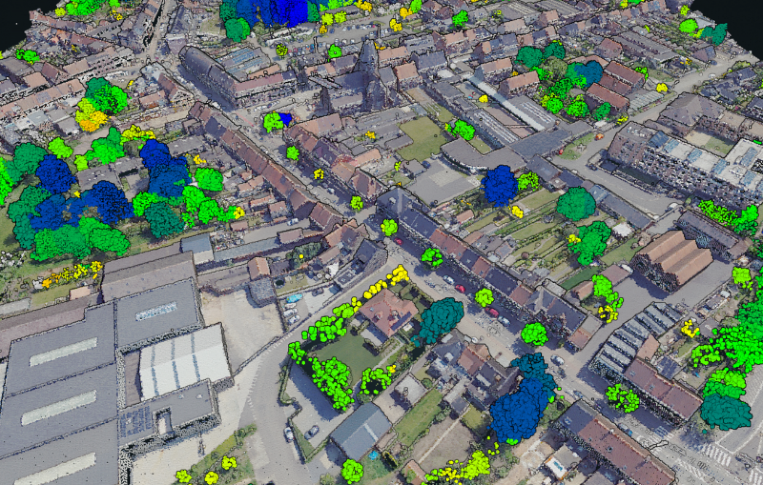
Belmap is expanding its data sources with a detailed tree register. Using LiDAR and artificial intelligence (AI), the platform identifies the location, height, and canopy width of every tree in Belgium. This allows Belmap to show how urban greenery and buildings interact — valuable insights for professionals working in safety, maintenance, risk analysis, and spatial planning.
Why tree insights matter for buildings
Trees enhance the livability of cities by providing shade, cooling, and biodiversity. Yet they can also pose risks — from storm damage and falling branches to root pressure on foundations. With objective and consistent tree data, Belmap helps insurers, asset managers, and local authorities assess risks, plan maintenance, and prevent damage.
How Belmap detects trees using AI and LiDAR
Belmap’s new tree register is based on AI analysis of LiDAR imagery. This technology detects individual trees, calculates their position, height, and canopy size, and links them to nearby buildings. The result is a unique data model that visually and quantitatively reveals the interaction between trees and built structures.

New data modules in Belmap
Starting from Belmap version 2025.12, two new modules will be available:
- Tree Core Module – contains the exact stem position, height, and canopy of every individual tree in Belgium.
- Building Tree Proximity Module – calculates how close trees are to buildings, how many are nearby, and how much their canopies overlap.
These modules enable users to measure, visualize, and predict the impact of urban greenery on buildings and infrastructure.
Applications of the Belmap trees
The Belmap tree register supports a wide range of use cases:
- Insurance and risk management – assess damage risks from storms, branch breakage, or root growth.
- Maintenance and asset management – identify trees that threaten façades, roofs, or pipelines.
- Energy and solar analysis – calculate shading effects caused by trees.
- Urban green management – monitor tree growth, density, and interaction with buildings.

In short
- Belmap now includes an AI-driven tree register with location, height, and canopy data for every tree.
- The Building Tree Proximity Module reveals relationships between trees and buildings.
- Users gain insights into safety, risk, maintenance, and value.
- The tree register supports spatial planning, insurance risk analysis, and energy management.