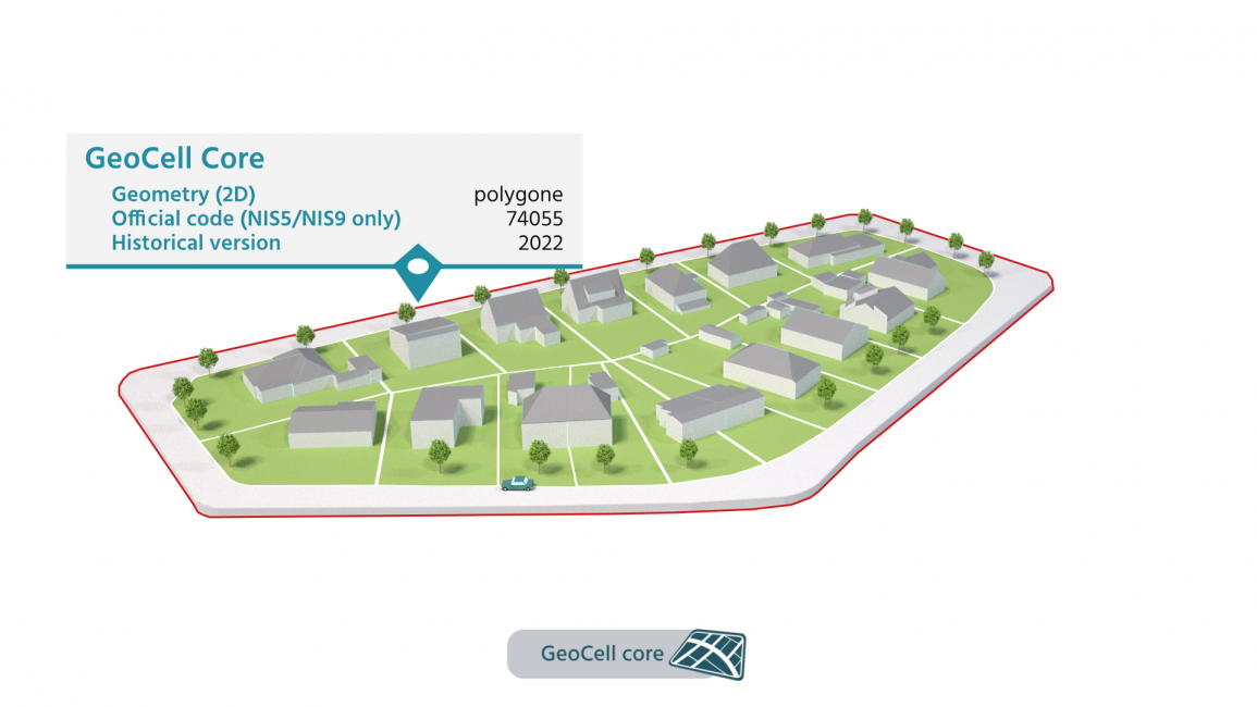
GeoCell is Belmap's unique spatial aggregation of addresses, buildings and parcels with similar profiles.
Belmap Geocells have different levels of granularity: Belmap's unique Geocell Street Segment level is the most detailed and corresponds to a group of 10 to 15 households. Other Geocell levels are statistical sectors and municipalities. Belmap will always provide the data at the most granular level possible, depending on the availability of information.
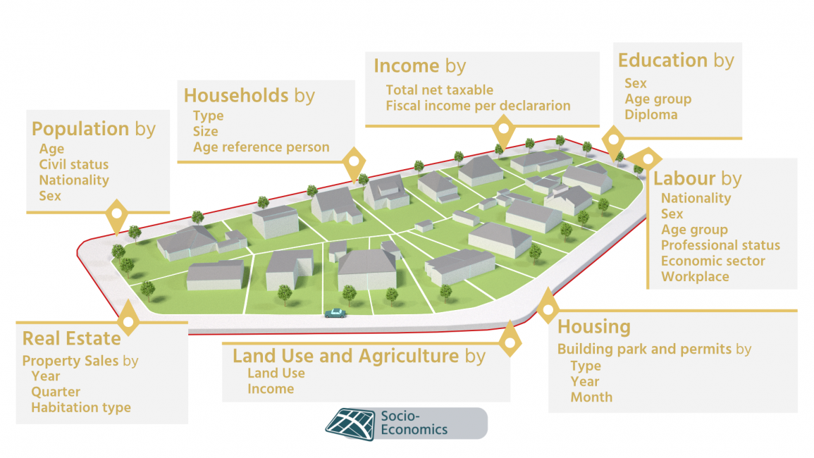
GeoCells give you detailed insights into socio-demographic themes such as population Households, Income, Real Estate, Labour, Education, Housing, Land use and Agriculture. The uniqueness of the GeoCell lies in its granularity, which gives you a much more detailed insight into the socio-demographic dynamics of a particular area.
For a better user experience, some data modules are available at address level (such as Address Geotype) or Building level. (such aBuilding Inhabitant Capacity).
Explore Belmap's geocell data modules